Cutting turfs
Why you cut walkable chunks, how to draw them, and what the time estimate means.
For campaign adminsA turf is a polygon on your address universe — a walkable set of doors. You cut turfs so each canvass has a clear footprint: not the whole ward at once, and not a vague “north side” in a spreadsheet.
Open Map & Turfs
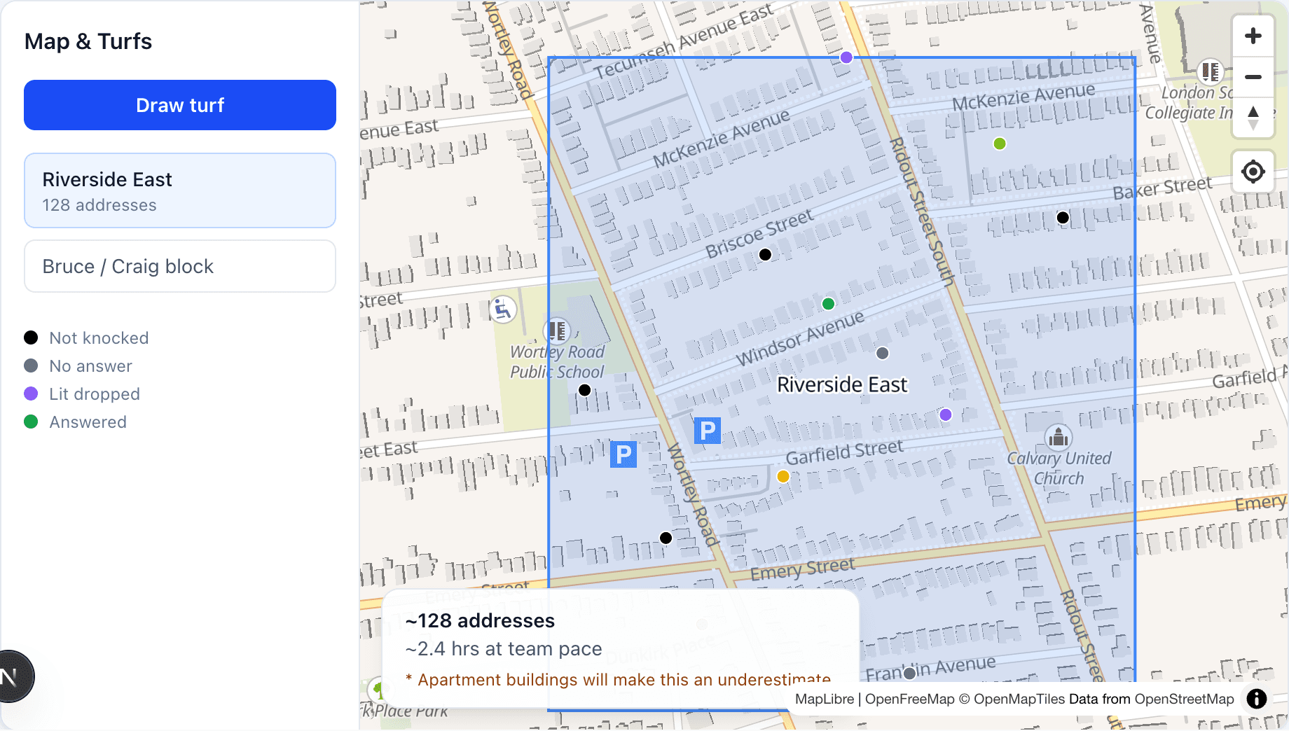
In admin, go to Map & Turfs. You will see universe dots colored by door status, existing turf outlines, and any canvassers currently live on a canvass.
Draw the polygon
Tap Draw turf, tap vertices around the block(s) you want, then Finish. DoorLine counts addresses inside the polygon with PostGIS before you save.
Name and optionally schedule
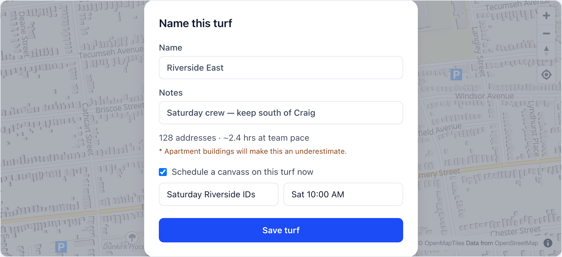
In Name this turf, give it a clear label (street names help captains). Add notes if useful. Optionally check Schedule a canvass on this turf now to create the canvass in the same dialog.
Time estimates
While drawing, you may see something like “~120 addresses · ~2.5 hrs at team pace.” That uses recent knock rates (houses/hr) when you have enough data.
Show, hide, delete
The turf sidebar lists every turf. Hide old turfs to declutter the map without deleting history. Delete only when you are sure nothing still needs that outline.
Draw a polygon when you want every door inside. If you only want chosen doors (a warm list spread across the ward), use Lit Drop instead — a hull would include houses you did not pick.
Next: attach turfs to work on the calendar in Canvasses.